Sunday, April 30, 2017

The Year of the Round Tuit

So, I tend more toward goalsetting than resolutions for the new year, which may be why it took so long to realize what this year is.   Yes.   I have a round tuit.

And apparently this is the year I am finally putting it to use.  Witness-

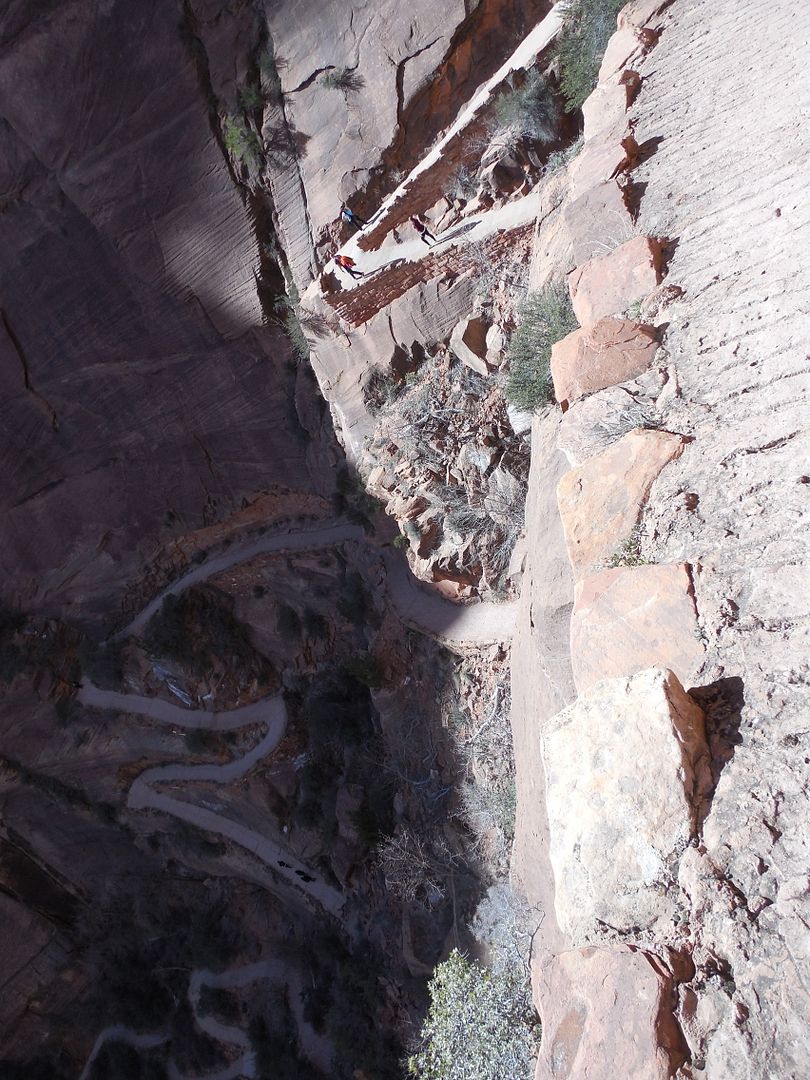
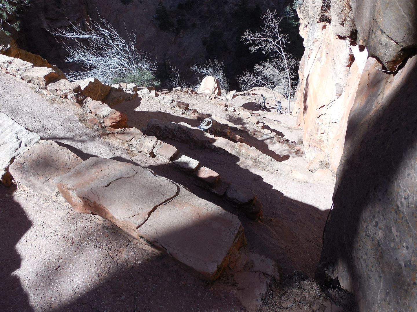
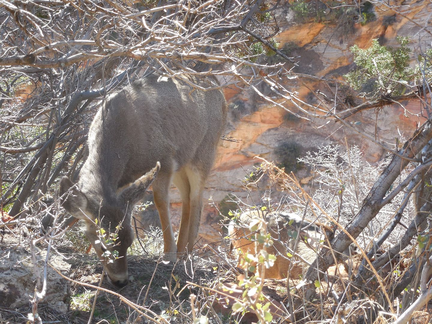
  • I have been meaning to get to western national parks for around 20 years.  Check.
  • Have been meaning to do more weekend trips.  So far this year, I have been to NYC and Toronto.  Check.  
  • I have been meaning to get to FilkOntario (a music event) for about 20 years.  Check- that was this past weekend.  
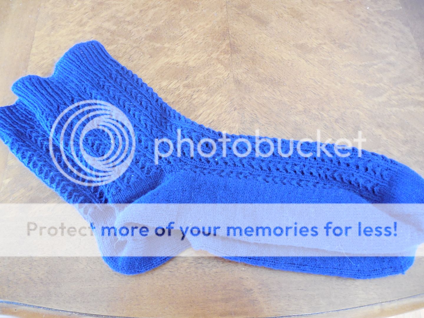
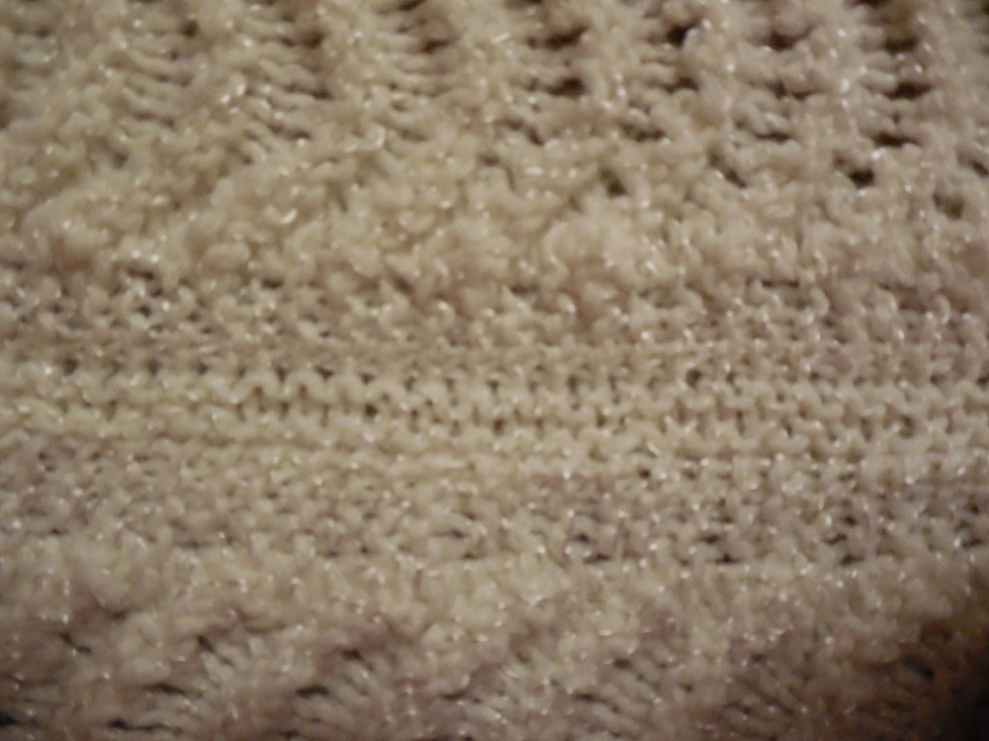
  • I have been meaning to make socks with that navy yarn.   Check.
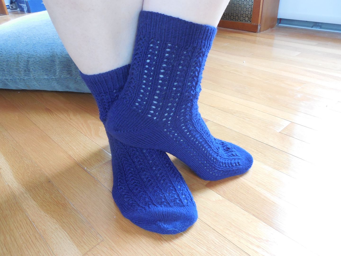
This is closer to the true color of the yarn, but it's still darker than it seems in photos. 
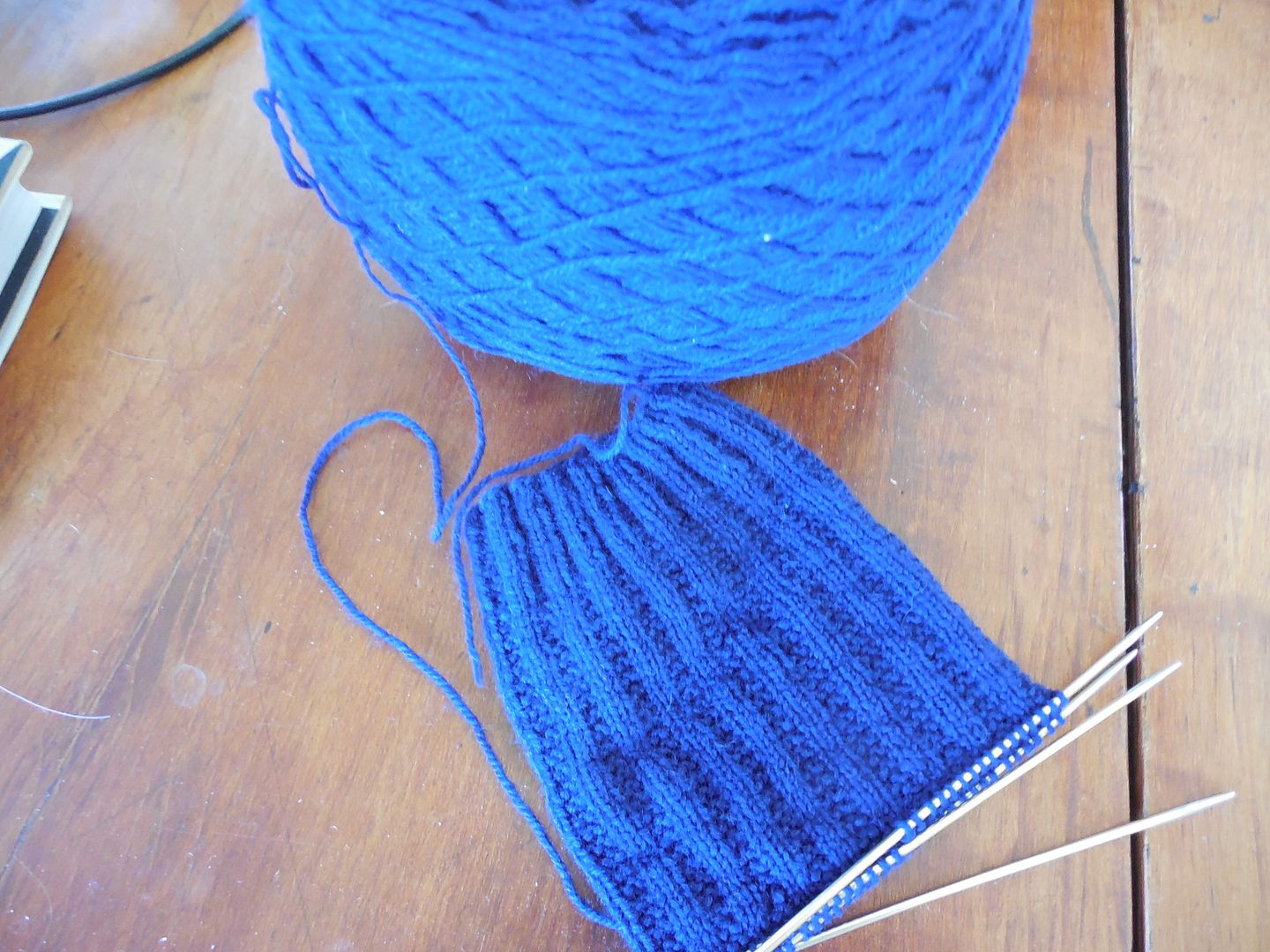
  • A second pair is on the needles as a traveling project. 

  • I've been meaning to turn those four inherited strips into an afghan.  I knit five more and used up another random ball of yarn for the border.  Check.  (Still need to weave ends in, but it's almost there.)
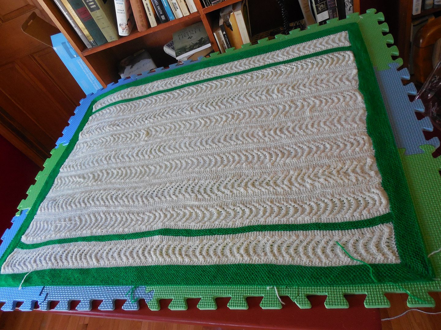
          I will note here that I wound up grafting the strips.  I tried a three needle bind off first.
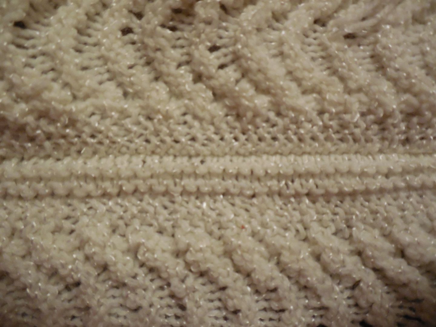
          But it just didn't look right.  See the seam abover the two rows of garter?
          Grafting gave it a much smoother finish.  Plus?  After all that grafting, I've gotten faster. 
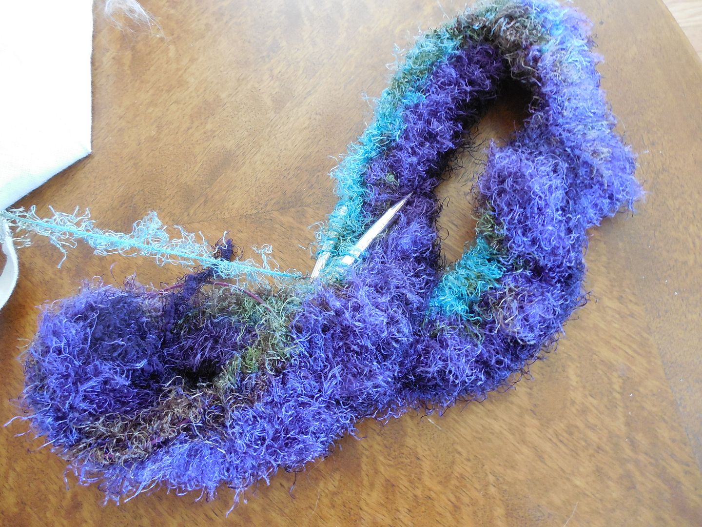
  • I wanted to use up random odds and ends of yarn.  Now one of the problems with this, is that one small ball of novelty yarn can be hard to find a use for.  But my mom gave me several more skeins a couple of weeks ago.  And with that, we have a project.  In this case, a cowl. 
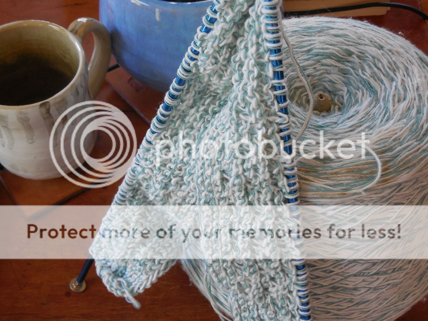
  • I have cast on a....well, I'm not sure.  Could be a baby blanket, could be a bathmat. But it's using some of a vast cone of cotton I've had lying around. 
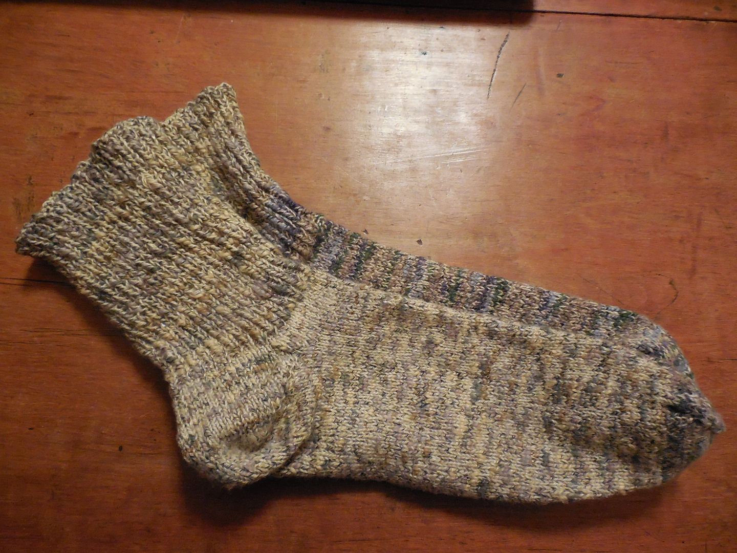
  • A few weeks ago, I darned an entire basket of socks that had been awaiting attention.  And as if that wasn't enough, I had a pair of cotton socks that I had made short, thinking they would be summer socks.  But the yarn was too heavy for summer wear and yet the socks were not tall enough to keep my ankles warm in cooler weather.  But I had yarn left, so I unpicked the bind-off and lengthened them, rendering them wearable. 
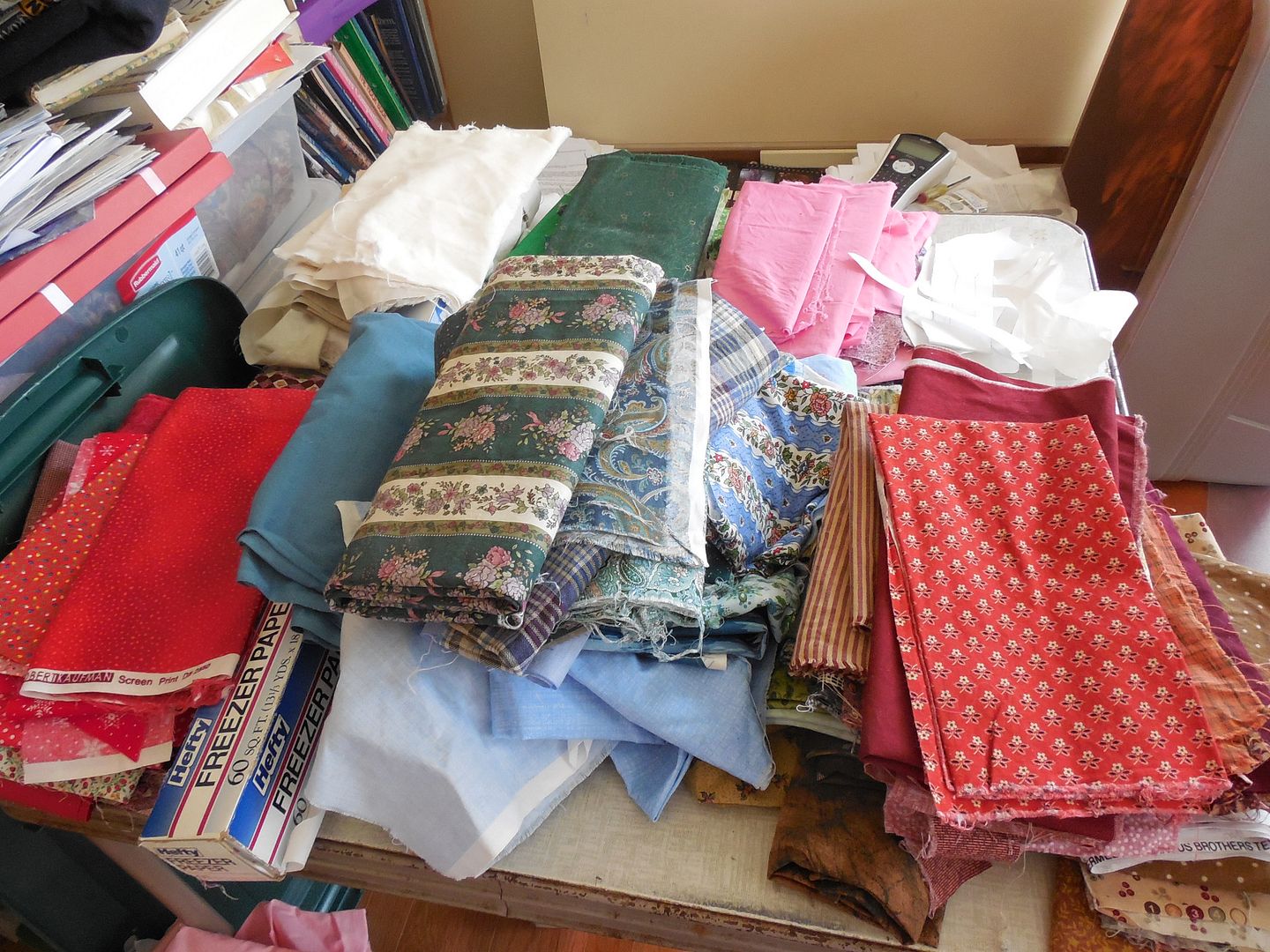
  • I have been meaning to finish ironing and sorting my quilting stash.  Almost complete- the last of it has been ironed and is waiting to be sorted.  After which, I am going to start laying out a new quilt- the first one in approximately forever.  (Actually, I finished the last quilt for a charity auction in 2006, but have done nothing since.)

And then in the FO department, there have been a few random things I've done.  A couple of pairs of adult mittens.

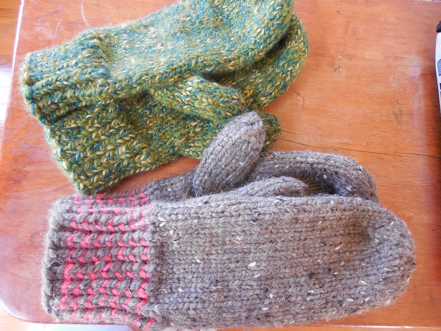
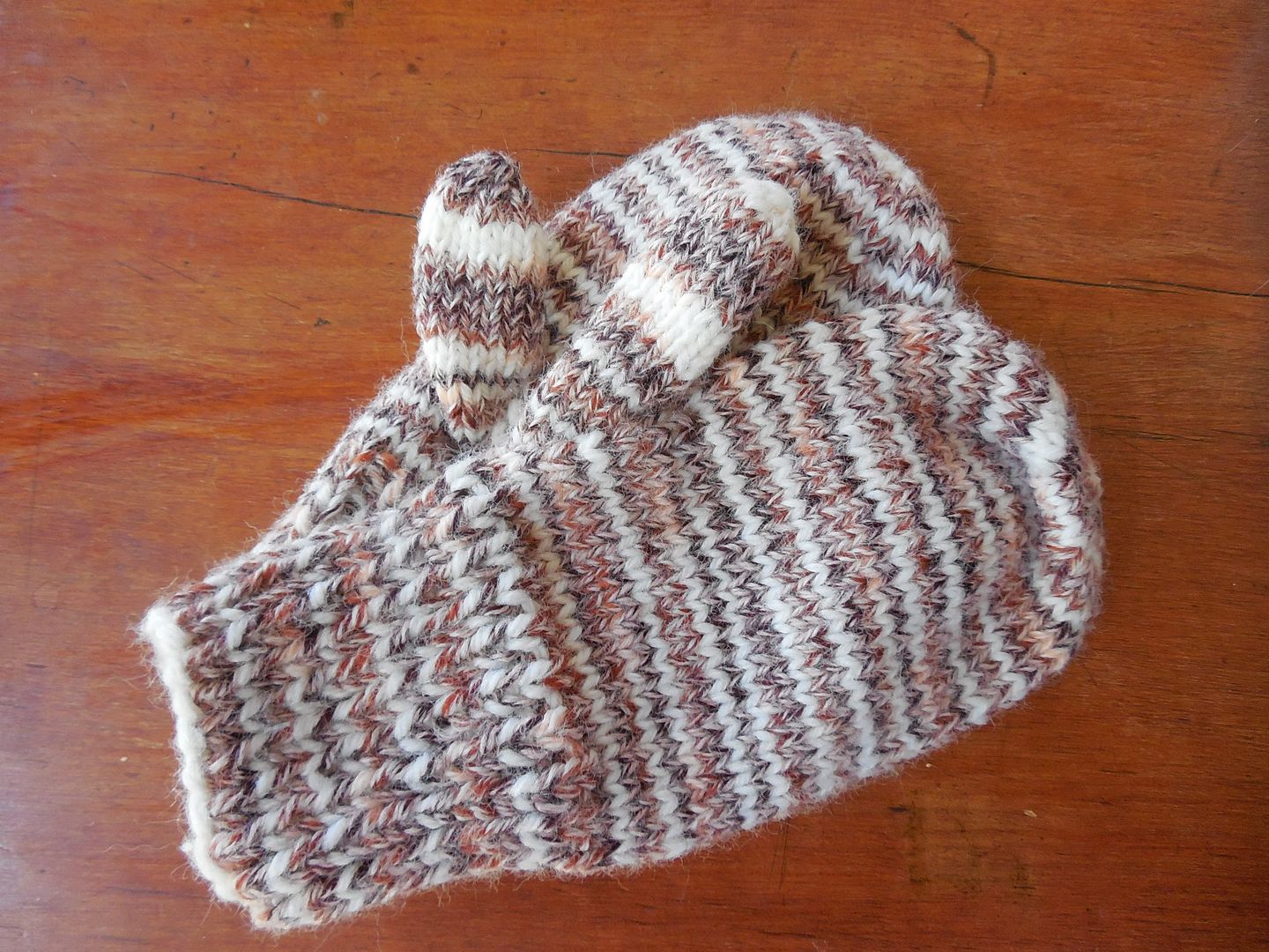
And another pair of kid mittens. Which has reduced the brown skein down to less than one mitten's worth of yarn.  

I'm feeling pretty good about the year so far.  I've made an actual dent in the deep stash, and progress is continuing.    We have two more trips planned for this year- one of which will be another 'we've been meaning to do this forever' trip.   And I've got ambitions.  This might well be the year we finally get out to Tanglewood, for example.    I'll keep you posted!


Thursday, April 20, 2017

Part the Last: Canyonlands

While Arches is about natural stone formations, some quite large, they are on a scale that humans can at least relate to.  Canyonlands is about landscape on the macro scale.  The canyons of the name were carved by the Green and Colorado Rivers, and they rival the Grand Canyon for sheer multi-level vastness.

We only visited one section of the enormous park, and were conscious of giving it short shrift.  It was the tradeoff for having taken scenic route 12 instead of a faster route, and spending a day and a half in Arches.  The above photo was taken from the Grand View lookout on the Islands in the Sky mesa. There were three other major sections of the park we didn't see at all.

We took a short hike out to see Upheaval Dome.   It's a crater-like feature whose origin has been hotly debated by geologists- the two leading theories are an uplifted salt dome, or an impact crater from a meteorite strike.  The meteorite theory is currently ascendant.

The day was beautiful and we cruised around the park with the top down on the convertible as we drove from point to point.   We hiked out to Murphy Point.  The trail led through grassland, quite unlike anything else we'd seen in the area.  And thin and tough as it was, you could see why cattle were grazed there (and still are- we passed a number of them, and had to let them cross the road ahead of us at one point).

As we approached the rim, the grassland suddenly stopped and the land turned into desert again.

The views were staggering.
Here's the Green River canyon seen from Murphy's Point.
In the far distance we could see the La Sal mountains (the name dates back to the Spanish and means 'salt').  We sadly left the park as the sun was going down.

And that was the trip- we drove back through the Rocky Mountains to Denver, with a stop in Vail for lunch (it was very posh, and I had to take a photo of the ski slope for a ski-obsessed coworker).   We walked around and had dinner in Denver and then flew home the next morning.   Which was blessedly on time and uneventful.  There was a blizzard predicted in Boston for the next day so I wound up stopping by my office for my work computer so I wouldn't have to go in the next day.  And then the day after *that* my office didn't have power (kind of a pity we hadn't just stayed and seen more West for a couple of days).  But it all worked out.

And- since I know you're wondering- I took a pair of socks with me on the trip, and they still aren't done!  (It has been a busy few weeks, and crafting time has been at a premium.)  But I'll show you various things-in-progress Real Soon Now.

And- the last slideshow:

Wednesday, April 19, 2017

Part the Sixth: Arches

We arrived in Moab in time for lunch, and unlike Panguitch, found it lively and filled with restaurants, art galleries and a charming bookstore.   We got a quick lunch and headed back to the park, where we saw the visitors center and set out to begin exploring the park.

Arches has the highest concentration of natural rock arches anywhere in the world- over 2000 of them.   The area was a sea 300 million years ago, and successive cycles of drying and inundation deposited a layer of salt that is thousands of feet thick in places.  Sediment deposited on top of it was compressed and and became layers of sandstone.   The weight of the rock forced the salt to flow, and raise up layers of rocks in salt domes.  The layers cracked and subsided, leaving long fins of rock.  After years of erosion, the fins became separated and softer layers collapsed underneath leaving freestanding arches of harder material above.   It's a process that is ongoing, as new arches grow and the oldest ones collapse.

In between the arches and rock formations, the desert stretched out, stark and beautiful.

It was important to stay on the trails, because the life in the desert may withstand heat, cold and lack of water, but not people trampling it.   Particularly vulnerable is the 'biological soil crust'- a collection of algae, moss, bacteria, lichen and fungi that collect on the surface, trapping moisture and making soil that other plants can then use for nutrients.

As in other parks, the colors were fabulous.

We were very struck by slabs of an odd greenish rock we couldn't identify.   A ranger told us later that the rock was chert and the green color was unreduced iron.  (Oxidized iron is what gives us red rock- I hadn't realized that that unoxidized iron would color rock green.)

Everwhere we looked, we saw fantastically shaped rock.
Or fantastically shaped wood.
We saw all the 'major' sites- such as Balanced Rock:
But even the smallest details were eyecatching.  The trail called Park Avenue is a dry riverbed, and the water has cut and swirled the rock, exposing striking strata.
We spent all afternoon, had dinner in Moab, and returned the next day for more.  In the morning my camera batteries died, so I took photos with my phone until lunch when we went back to town and I could get more batteries. 

Despite the difficult conditions, plants managed to survive.  This little clump of flowers was growing in the middle of the trail. 

Of all the parks we visited, Arches was my favorite, but not because of the arches- it was just something about the vistas, the openness,  the colors and the shape of the scenery.  

We returned to town reluctantly and sought out dinner.  The next day would be our last day in Utah. 

The Arches slideshow:

Monday, April 10, 2017

Part the Fifth: Scenic Rte 12

After watching the sun rise over Bryce Canyon, we set off for Moab.  We'd gone back and forth about taking the scenic route vs. the interstate, but the presence of a small museum in Boulder, Utah tipped the balance.  We quickly found out how it earned the tag 'scenic'.

The road crosses parts of the Grand Staircase-Escalante National Monument, through some of the wildest and most desolate terrain to be found in the southwest.  Informative placques (have I mentioned lately how much we adore informative placques?) told us that this was the last part of the continental US to be completely surveyed and mapped.
The road was built by the Civilian Conservation Corps between 1935 and 1940, and it took not just 5 years but tons of dynamite to blast a road through the rocky landscape.

The town of Boulder was the last place in the US to get mail by mule train, and it wasn't until 1947 when the CCC finished their road that they got electricity.    We stopped there to see the Anasazi State Park Museum.   The museum was interesting, but the real attraction is the ruins of an Anasazi village, that was occupied by about 250 people between 1160 to 1235 AD.  The rooms with firepits in the center were living spaces, and the ones without were used for storage.
Grinding stones would have been used to grind corn.
And pit dwellings provided relief from both the coldest and the hottest temperatures.
The logs would have been covered with branches and clay.  The ladder giving access through the roof is believed to reference a creation myth wherein humans emerged from the ground.

From the museum, the road continues up over the shoulder of Boulder Mountain, into aspen and pine forest with amazing views out over the Escalante river valley.

And all this was just the morning- we arrived in Moab in time for lunch.  But that's another post.

Friday, April 7, 2017

Part the Fourth: Bryce Canyon

The day of our arrival, we took the auto road around the canyon and took in the view from all the scenic overlooks.   The rock formations (hoodoos) are spectacular, and full of color.

If you could look over the near scenery, the Henry mountains in the distance were handsome as well.

Aside from driving over the Continental Divide later in the trip, Bryce was the highest point where we spent any time.  There was still a lot of snow, and I could feel the altitude, especially the first day.   We pulled out a snack at one of the lookouts and were the immediate subject of considerable interest.
The signs were quite clear that feeding the wildlife was verboten, but the wildlife did its best to convince us that this was more of a mild suggestion than an actual rule.  (We didn't buy it.)   This raven followed us around until the food was gone, gliding ahead of us, stopping, watching us expectantly as we walked toward him--and then passed him without sharing.  Then repeating as if surely it was some kind of mistake that we hadn't succumbed.   However we have been mooched from by real pros (yes, Jake, it's almost bedtime snacktime) so we stayed strong.

It was quite early in the season for Bryce- some trails were closed, and we were somewhat disappointed to find that the prairie dog viewing area was still under a foot or more of snow.  Fortunately we found that there was a family of prairie dogs living in front of our motel, so we got to see some scampering and playing anyway.
That night we went into the nearby town of Panguitch (which means "Big Fish") to get dinner and found that although the number of (mostly closed) motels showed that tourism was what keeps the place afloat, there wasn't a particularly concerted effort to exploit the vast number of visitors to Bryce.  Most of the town was closed for the season and it appeared to be a pretty sleepy place even when it was open.

The next day we went hiking down into the canyon.  The signs had all advised wearing hiking boots, which we had unfortunately not brought (on account of weight).  The trails were variously muddy and icy, and we were quite sorry we did not have boots, but we managed, though we were rather covered in Bryce Canyon mud by the end of the trek.   The scenery was absolutely worth it however.   Every time we moved a few feet along the trail, the angle of view would change.   I remarked that it was hypnotic in the same way that watching ocean waves is- you can stand there picking shapes out of the scenery and keep finding new details to admire.

Like Zion, the fantastic shapes of dead wood caught the eye.
The trails wind around the rock formations, through pine groves and back up the canyon walls.
The skinny ledge crossing the slope on the right is the trail.
At the end of the day, we stayed to watch the sun set from Sunset Point.

We left after the sun went down, and went to dinner, then came back to see the stars come out.  There were some high hazy clouds, so the seeing wasn't as good as we hoped, but my husband (who's first degree was in astronomy) was able to pick out Venus, several constellations and the Pleiades.

We went back to the hotel for the night, and got up very early the next morning to see sunrise at Sunrise Point.

It was breathtaking.  As the sun crept across the hoodoos, we set off for the next leg of the journey- scenic byway route 12, headed east to Moab.

Saturday, April 1, 2017

Part the Third: Zion

Darkness had fallen while we were driving to our hotel in Springdale, Utah the night before, so we had no preconceptions when departed for the park in the morning.  Sure we saw mountains around Springdale, but it wasn't the same as what greeted us along the Virgin River valley.

It was quite a cold morning, there was ice on the trail and I was wearing all the layers I'd brought, and feeling grateful that I'd included mittens and a knitted headband to supplement the hood on my jacket. It was early enough that the bottom of the canyon was in shadow, but as we walked along the riverside trail, the sun rose and illuminated the rocks and water.  The colors changed and became more vivid as the landscape brightened around us.

The riverside trail ends at the Narrows, where in order to continue hiking you need specialized gear- waterproof hiking boots and dry suits to let you hike up the riverbed.
The Narrows

We'd decided that it was too chilly to make that attractive, and turned back to explore other parts of the valley.   We set out to hike up to the Emerald Pools- by this time the sun was warming the valley substantially.
The trail took us a gentle rise up the side of the canyon, giving us new views of the river and valley.

We attained the Upper Emerald Pool while it was still in deep shadow.   The trickle of water that filled it landed on a bank of ice.  As the sun crept across the pool, and lit the cliffs above, the water volume increased from a trickle to a steady stream.

The water was utterly clear, and without touching, you couldn't tell whether ripples in the bottom were modern sand or ancient seabed.   In fact they were both.
At this point we had hiked much of the moderate trails, so we took a stab at the West Rim Trail, which ends at Angels Landing- a very steep cliff.  Even from the lower part of the trail, the views were fabulous.
In places the contrast between the strata of the cliffs and the marks of the water that carved the canyon were striking.
After a rather steep and open stretch- where I kept to the inner cliff wall because the ankle high curb on the outside of the trail did not give me an immense sense of security!
West Rim Trail
--the trail turned back out into a high canyon, and then led up a series of short steep switchbacks known as "Walter's Wiggles".   They take their name from Walter Ruesch, the park's first superintendent, who had the trail to Angel's Landing constructed in 1926.  Here we are looking down on them.   Yes, that's another hiker starting up them on the first switchback.
Looking down on Walter's Wiggles
I made it up as far as Scout Lookout, which was a saddle before the final ascent to Angel's Landing and gave fantastic views on both sides of the ridge.
The final ascent was more or less straight up, with chains embedded in the rock so you could pull yourself up.  Being late in the afternoon, there were a lot of people coming down, and no place to stand to let them pass.   I opted not to attempt it.
I spotted a number of mule deer on the way down.  They were pretty blase about the hikers.
At the bottom, I took even more photos of the river, but the colors were so amazing and gorgeous, I never got tired of looking at it.
And while the sweeping views were entrancing, the nearer landscape was also interesting.  The vegetation is very different from what I see in the east, naturally, so I was always looking at the pinion pines, the sagebrush and cottonwoods, the occasional cactus and agave, and even the dead wood along the trail- twisted into fantastic shapes by the environment and then left exposed.
We were loathe to leave the park while there was still daylight, so we took another short hike up to a feature called Weeping Rock.   What happens is that rain and snow fall on the tops of the canyon and the water sinks down through the porous upper layers until it hits a denser layer, and then it runs on top of that layer until it reaches the canyon wall and runs out.  The water supports a variety of vegetation.  The trail runs up to the base of the rock wall and then into an undercut so you actually stand behind the falling water and look out at the valley.
At this point we were starting to think about dinner so we reluctantly left the park.   The next morning we cut through the park and stopped to take the short hike to the Canyon overlook.   It was warmer and brighter than the day before and the overlook trail caught the morning sun.
The view from the overlook was spectacular.  Here we're looking down the valley from near the east entrance.
We continued on our journey with sun and sky and the colorful rocks still dazzling our vision.  Zion is aptly named, I think, "Beautiful for situation, the joy of the whole earth".

And if you haven't had enough, here's the whole slideshow: